Mississippi Alluvial Plain (MAP) Regional Water Availability Study
Status of Water Resources
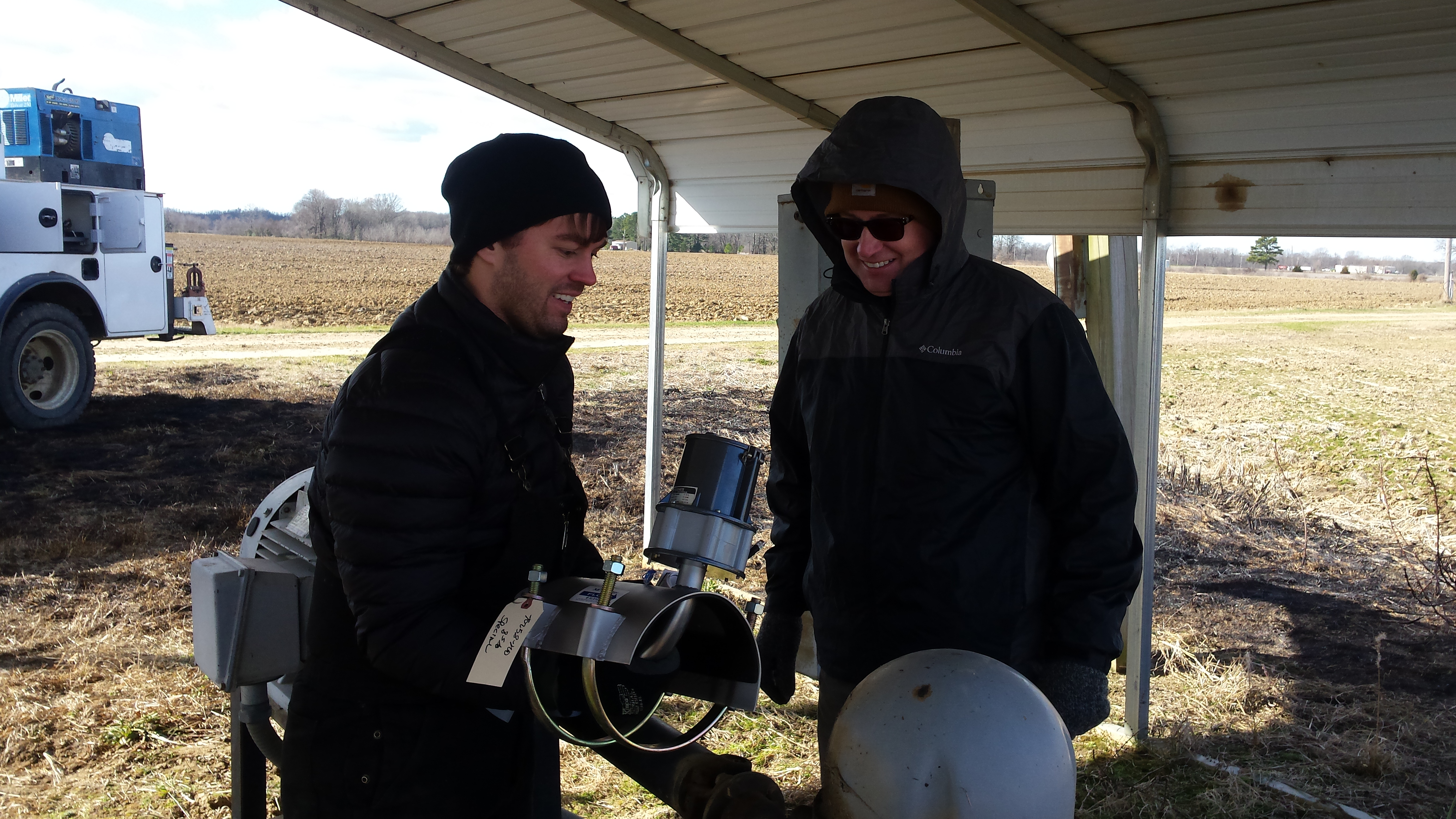
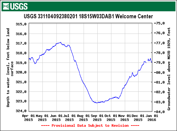
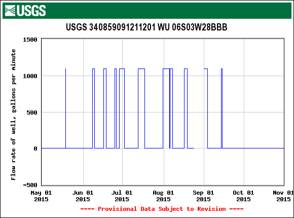
One of the most important components in a groundwater model is groundwater level data. Most of the water-level data used to document changes in the MAP groundwater system are collected in privately owned irrigation wells. Since these wells are actively used for irrigation, an assessment of the groundwater system is limited to only snapshots before and after the irrigation season. Additionally, water-use data is often estimated and may omit significant factors that can lead to highly variable and uncertain water-use data for the MAP groundwater system. Improving the monitor network and frequency of metering will help to provide accurate local data on groundwater use, to support broader efforts to better understand regional water use and to improve the management of the MAP groundwater system resource. It is also important to work with our federal, state, and local cooperators to ensure relevant data are obtained, collated, and reconciled with new and existing groundwater-level information provided from multiple organizations working in the region.Accurately estimating water use from the MAP region is critical to understanding the hydrologic budget, how the MAP regions responds to stress.
Current groundwater-level data collected within the MAP region can be viewed and downloaded from the Water-Use Real-Time Gage map. Reported water-use data from the USGS is currently available for Arkansas at the respective link.
- Install and instrument a network of groundwater level monitoring wells throughout the MAP to provide: changes in water-level throughout the year and for comparison to water-level measurements influenced by irrigation.
- Produce maps showing annual groundwater level changes and annual change in water storage for the MAP groundwater system.
- Upgrade selected flow meters currently installed on irrigation wells to transmit and record water-use data in real-time.
- Read, store, and serve to the public real-time water-use data received from flow meters.
- Perform cross-validation analysis to evaluate reported water-use and flow-metered data.
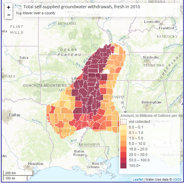
Water use for the Mississippi Embayment
Click the image below to explore how much surface and groundwater is used for a variety of categories from 1985 to 2010