
Mississippi Alluvial Plain (MAP) Regional Water Availability Study
Water Budget
Accurate assessments of water availability in the MAP area include improved estimates of water-budget components. The specific objectives of this program task over the course of five years will be to:- Assess and compare available options for water budget component estimation in the region (i.e., evapotranspiration, recharge, runoff, and storage change).
- Modify monthly timescale remote sensing-based water budget estimates to incorporate all available local data to accurately model depletion and water availability.
- Compare remote sensing-based estimates of evapotranspiration, runoff, and recharge with Soil-Water-Balance model results and field data to test and improve methods.
- Provide tested, synthesized estimates of monthly timescale recharge data for MERAS groundwater flow simulations.
- Examine impacts of varying water use practices, such as specific irrigation methods, on water retention or loss, particularly through the use of high-resolution (field-scale) remote sensing data.
- Use tested modern water budget estimates to develop relationships using historical monthly timescale temperature and precipitation data to develop water budgets for the MAP back to 1895, with recharge estimates provided for historical MERAS groundwater flow simulations.
- Project water availability estimates into the future using climate change predictions and exploration of different water use practice options.
- Synthesize results into a summary of the regional water availability and its projected changes under various management scenarios.
Estimating Recharge and Evapotranspiration
A variety of tools and approaches will be leveraged to assess and predict water availability with the best possible accuracy and spatial/temporal resolution. The magnitude and distribution of recharge (and evapotranspiration) will be computed for the MAP study area using field data, regionally available spatial datasets and two complementary estimation approaches: (1) the Soil-Water-Balance (SWB) model (Westenbroek and others, 2010), and (2) remote sensing and ground-based data combination.The SWB model calculates spatial and temporal variations in groundwater recharge based on climatological data, and soil and landscape properties. The SWB code uses a modified Thornthwaite-Mather soil-water accounting method (Thornthwaite and Mather, 1957; Westenbroek and others, 2010) to calculate recharge for each cell in the model area. Once the maximum soil-water capacity is reached for a cell, recharge is calculated as the difference between model sources (precipitation, snowmelt, and runoff from upstream cells) and sinks (interception, evapotranspiration, and runoff to downstream cells) (Stanton and others, 2011).
The data available through remote sensing have a great deal of potential to help inform water availability estimates and projections in the MAP, as these data have the advantages of broad spatial scale, high frequency of measurements (~ daily to monthly), and ever improving spatial resolution. The primary remotely sensed quantity of focus will be evapotranspiration (ET), which is the single largest water budget component, difficult to measure, and a key variable impacted by water use decisions. Remote sensing-based estimates of monthly ET will be combined with ground-based estimates of surface runoff to produce estimates of monthly recharge to be compared with SWB estimates. The comparison among SWB recharge, remote sensing-based recharge, and field data will yield a final synthesized recharge estimate that can be used as an input to improve accuracy in the MERAS groundwater flow model.
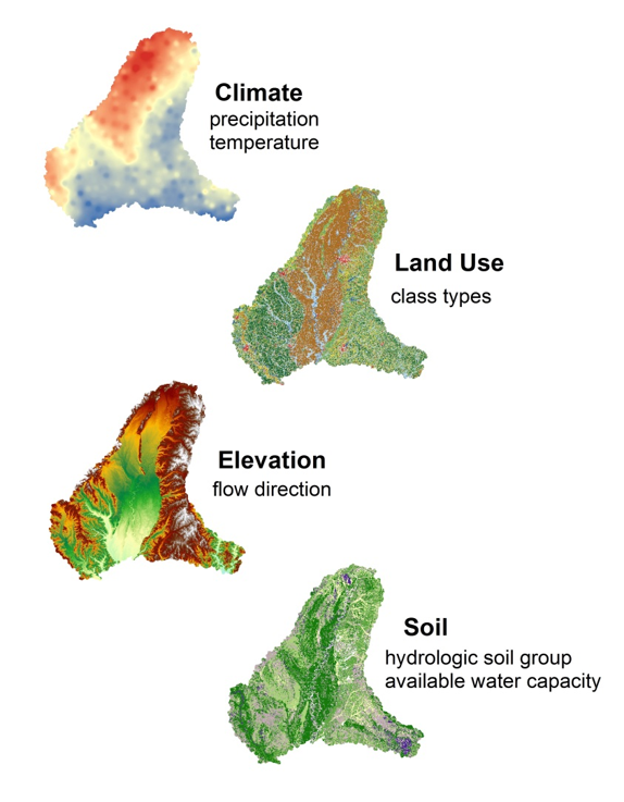
SWB uses gridded elevation, climate, landuse, and soil inputs to estimate to a timestep as small as a day or large as a year.
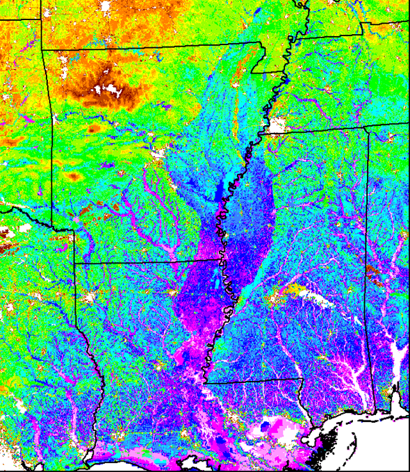
Example of remotely sensed data represented by a continuous grid that can be used to derive recharge and estimate over the MAP region.
Estimating Water Use
New* - Map of Water-Use Real-Time GagesMethods for reporting or estimating water-use data vary among the states in the MAP. Arkansas for example, records information about site-specific water-use locations and includes attributes related to crop type, and irrigated acres. The Arkansas data can be further investigated by clicking here. The goal will be to test and develop several methods for estimating water use in an effort to minimize inconsistencies, missing data, and help quantify uncertainty within the data.
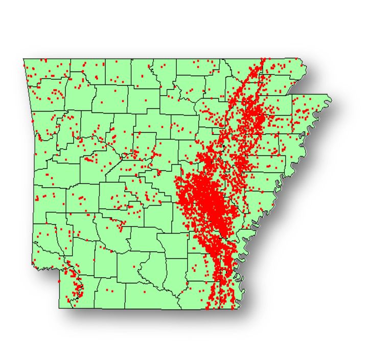
Map showing the surface water locations that report water use annually within Arkansas that are attributed with monthly and annual water use, crops irrigated, and number of acres.
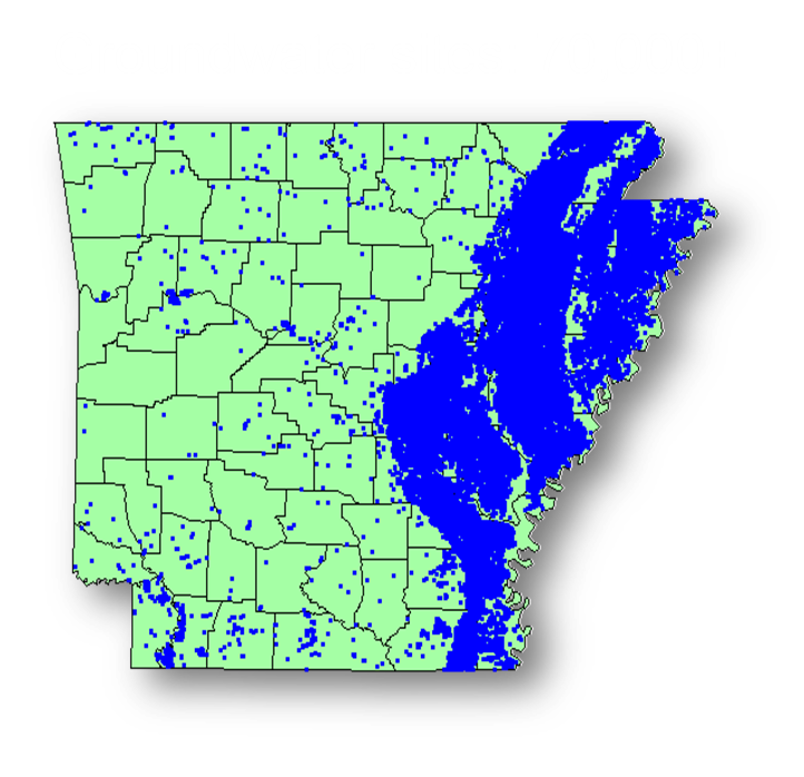
Map showing the groundwater locations that report water use annually within Arkansas that are attributed with monthly and annual water use, crops irrigated, and number of acres.
- Analysis of crop coefficients and ranges of values: water-use estimates can be statistically estimated using independent variables when possible.
- Evaluate water use with remote sensing and GIS techniques: Use satellite based data, such as land-use/land-cover to compile crop type, acreages, and meteorological based data.
- Assess current efforts in real-time and direct gaging of groundwater wells: Improve spatial density and representation of water use through the MAP region.
- Comparison with Soil-Water Balance methods that produce estimates of irrigation based on crop-water demands (See Recharge section).
- Use of remote sensing-based estimates of crop water consumption (ET) in areas with high-quality, high-resolution water use data to evaluate remote sensing ET as a tool for estimating water use in areas where use data is lower quality/resolution.
Connecting Water Use to Water Availability
As the sustainability of groundwater resources becomes a critical issue, more data is needed to understand quantitatively how water use decisions impact the water available for future use. The primary purpose of groundwater pumping in the MAP is agricultural irrigation. Some of the water used for irrigation recycles back into the local water system through runoff and recharge, but the majority of this water is lost from the system to evapotranspiration. Quantifying the rate of evapotranspiration in irrigated areas will be a way to quantify irrigation efficiencies for different irrigation methods and crop types.
Remote sensing ET data are available at 30m resolution, which allows for distinguishing between individual fields (Allen and others, 2007). This remote sensing ET data will be compared with USGS water use databases in the MAP to draw conclusions about efficiencies of different irrigation methods and crop types. This study of the irrigation water loss efficiency of different irrigation methods and crop types in the MAP will provide useful data for discussions about best practices for irrigation methods, or long-term crop type planning.
Estimating Surface Water Flow
Streambed conductivities in the Mississippi Delta area of the MERAS model are an important parameter when evaluating water management scenarios that may involve infiltration wells along streams or inter-basin transfers of water from one stream to another. Declines in groundwater levels have resulted in decreases in baseflow in many Delta streams to the extent that in the absence of rainfall or irrigation return flow, some stream reaches are dry during the summer months. To better understand how surface water fits into the overall MAP water budget, approximately 170 streamflow characteristics will be estimated using statistical methods coupled with available gage data.
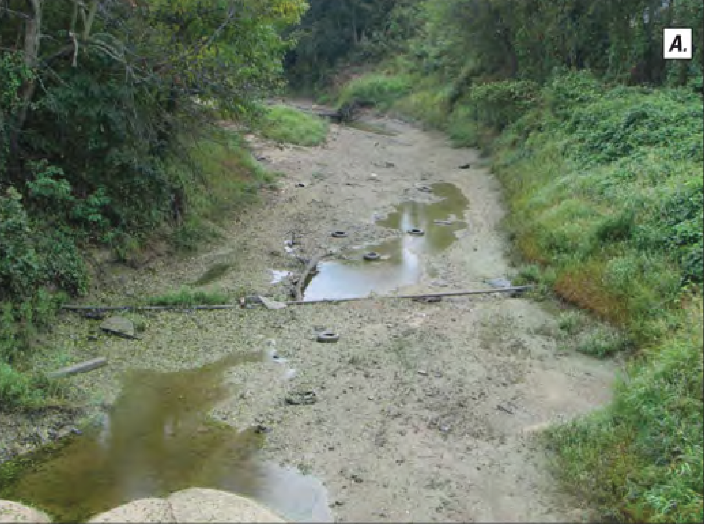
Dry streambeds during the summer months due to lack of base flow for Big Sunflower River at Sunflower, Mississippi. Photos by Jeannie Barlow, 2008. Public domain.
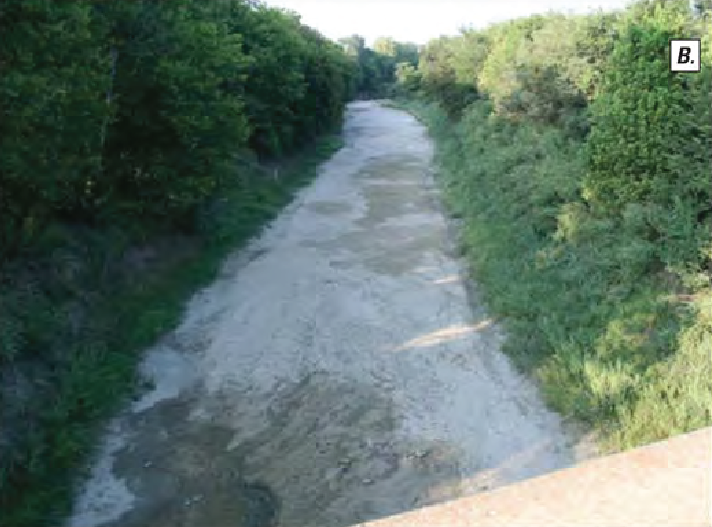
Bogue Phalia River near Leland, Mississippi. Photos by Jeannie Barlow, 2008. Public domain.