
Mississippi Alluvial Plain (MAP) Regional Water Availability Study
Enhanced Characterization of the Hydrogeologic Framework
Hydrogeophysical surveys have become an integral part of understanding hydrogeological frameworks used in groundwater models. Regional models cover a large area where water well data is, at best, scattered and irregular. Since budgets are finite, priorities must be assigned to select optimal areas for geophysical surveys. The main objective of geophysical surveying is assumed to estimate values and spatial variation in hydrologic parameters (i.e. hydraulic conductivity) as well as map lower permeability layers that influence the spatial distribution of recharge flux.The specific objectives of this program task over the course of five years will be to:
- Compile available data from state agencies to design an airborne geophysical survey to map critical groundwater areas in Mississippi and Arkansas
- Conduct airborne, surface, and borehole geophysical surveys to:
- Evaluate the geometry of the MAP groundwater system
- Map the 2 and 3-dimensional distribution of subsurface geologic properties controlling the flow and storage of groundwater
- Map the potential for interaction between the stream and groundwater systems at selected stream locations in Mississippi and Arkansas
- Develop a 3-dimensional framework for the MAP groundwater system
Shellmound, MS Geophysical Survey
The area near Shellmound, Mississippi is the focus of a U.S. Geological Survey (USGS) hydrologic mapping and modeling effort to support a managed aquifer recharge pilot study being conducted by the U.S. Department of Agriculture (USDA) Agricultural Research Service (ARS) and other local stakeholders. The pilot study is investigating the use of bank filtration from a gallery of extraction wells adjacent to the Tallahatchie River. This extracted water could be used as a source of focused aquifer recharge via injection wells in an area of groundwater decline in the Mississippi River Valley alluvial aquifer (MRVA). To support this investigation, the USGS Mississippi Alluvial Plain (MAP) Regional Water Availability Study carried out airborne and ground-based geophysical studies in the area to improve understanding of the geology and structure of the aquifer system.Continuous Resistivity Profiling
Continuous resistivity profiling is used to map the electrical properties of near-surface materials. Based on the resulting electrical properties the geological materials can be determined. Fine-grained materials, such as clay and silt, easily conduct electricity while coarser-grained materials, like sand, are resistant to electrical flow. Since the geologic materials have a direct impact on groundwater flow, knowing the distribution of these materials is important pto understanding regional groundwater systems.Waterborne
Waterborne resistivity surveys were conducted along 180 km (111 mi) of three rivers (Tallahatchie, Quiver, and Sunflower Rivers) in the Yazoo Basin of Mississippi during June 2016. Surveys were conducted a direct-current resistivity system that tows a 70 m-long floating, multi-electrode cable behind a slow-moving motorboat proceeding upstream. Electrodes transmit a low current into the bed materials of the stream and receive a signal back which allows the user to map the geology of the streambed. By understanding the geology of the streambed, the connectivity between surface streams and underlying groundwater systems can be better understood. This work will be used to scale streambed groundwater flow rates for incorporation into a regional groundwater flow model, which may be used to guide policy decisions.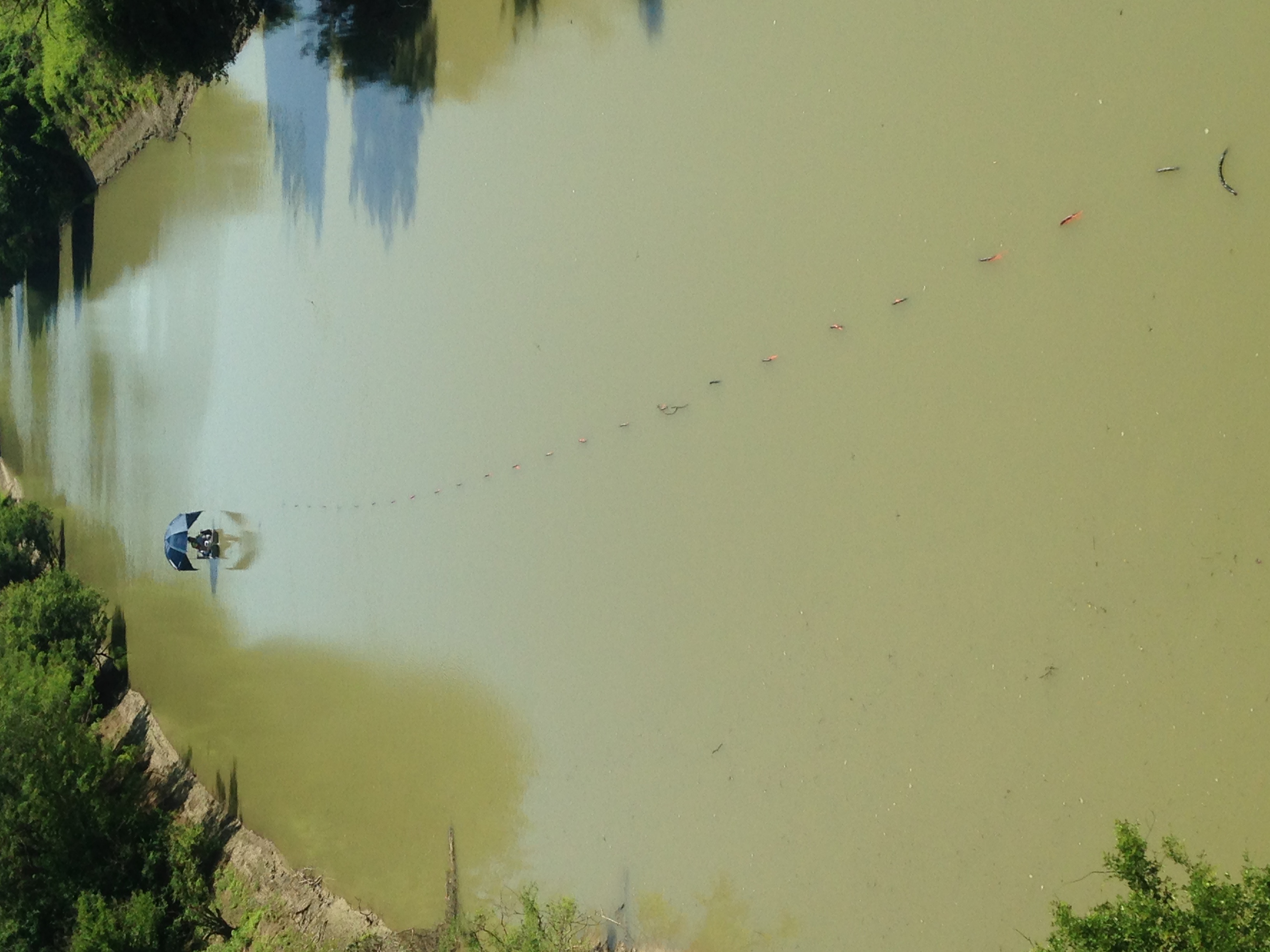
Waterborne resistivity crew conducting a resistivity survey of the Quiver River, Sunflower County, Mississippi. Electrodes on a floating cable are visible behind the boat, which is travelling upstream. Photo by Ben Miller, 2016.
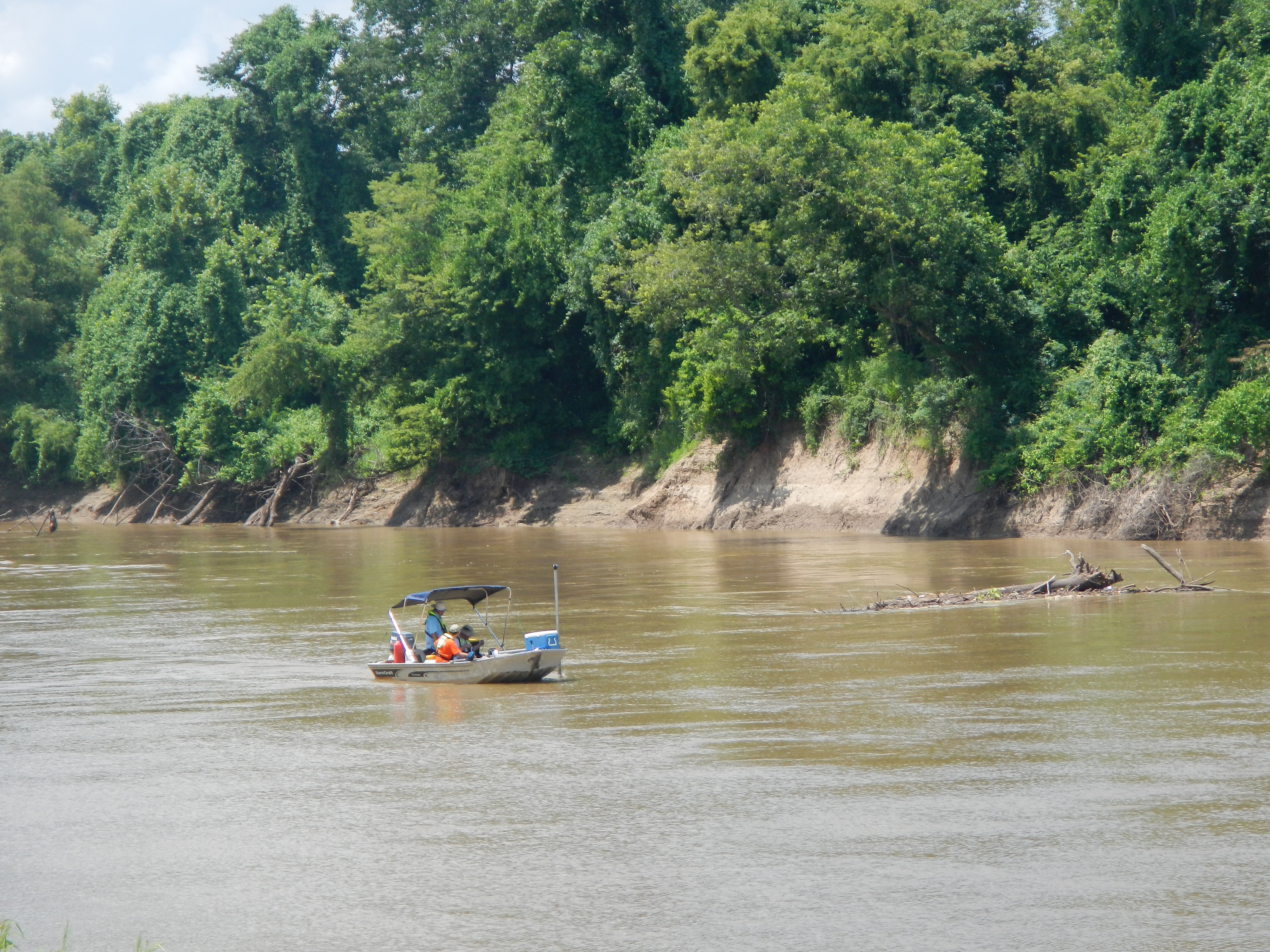
Waterborne resistivity profiling in progress on the Tallahatchie River, Leflore County, Mississippi. GPS unit and depth sounder are visible attached to the front of the boat and the cable with electrodes can be seen just behind the outboard motor. Photo by Shane Stocks, 2016.
Land-based
Land-based resistivity surveys were conducted in August 2016, using an capacitively-coupled resistivity system which allows the user to map the near-surface geology by pulling a series of seven electrodes behind a vehicle along dirt and gravel roads. Low currents transmitted into the earth, via these electrodes, are used to map the near-surface geology of the surveyed area. Variations in the geological materials of the Mississippi Alluvial Plain can significantly influence the rate at which an aquifer is recharged. These geological materials have a direct result on groundwater levels and flow rates. This work will help to understand the influence that the near-surface geology has on the groundwater flow of the region.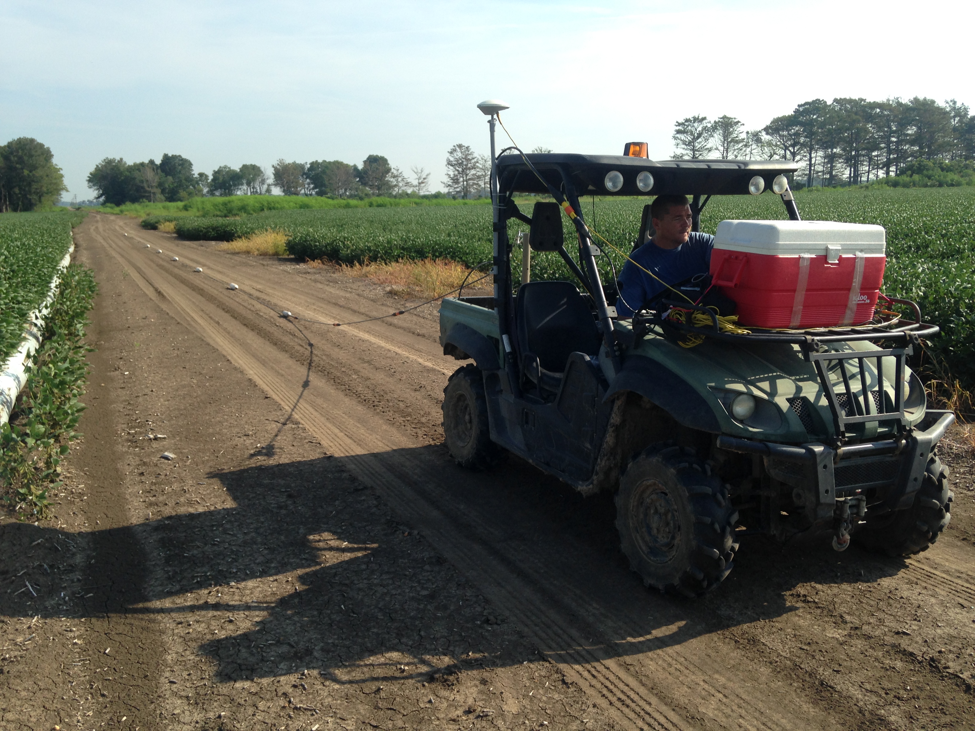
Jason Payne driving an ATV pulling an array of electrodes for mapping the near surface geology in the vicinity of Steiner, Mississippi. Photo by Ben Miller, 2016.
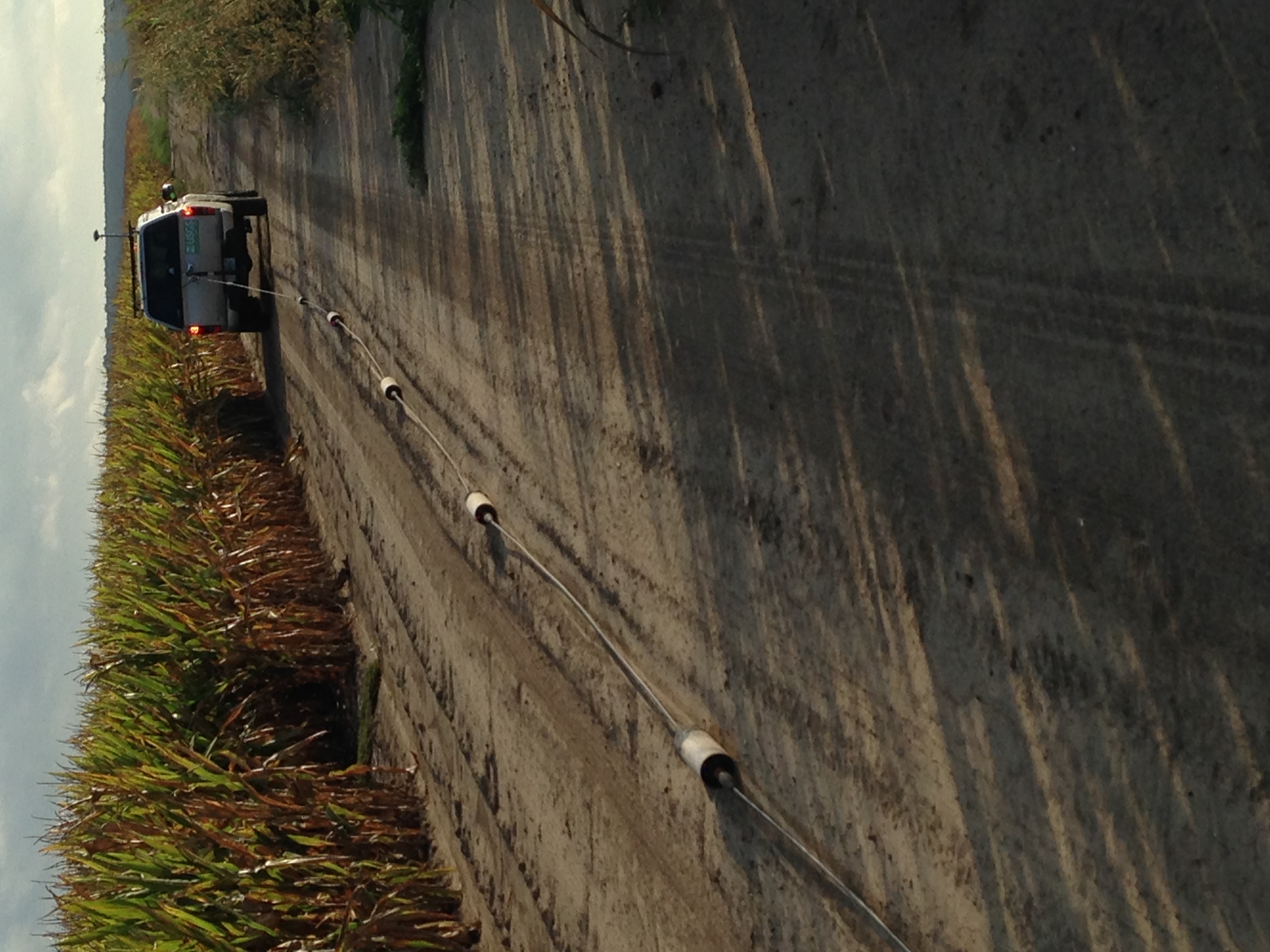
View of the Ohmmapper system electrodes being pulled behind a small truck in order to map the near surface geology of Sunflower County, Mississippi near the town of Shellmound. Photo by Ben Miller, 2016.
Airborne
The airborne electromagnetic (AEM) methods are geophysical measurements that measure variations in the electrical resistivity of subsurface materials by sensing the flow of electrical currents in different types of geologic deposits (Smith and others, 2007). An AEM survey has several advantages, including the ability to map large areas with a higher density of data coverage and the ability to cover areas with rugged terrain, and is a noninvasive method of data collection using a helicopter or fixed-wing airplane (Ball and others, 2011). Historically, AEM surveys have been used to map mineral deposits; however, it has been increasingly used for geologic and hydrologic studies (Smith and others, 2007). The AEM method has proven effective for mapping groundwater supplies because of the distinctive resistivity signatures of water-bearing geologic materials (Smith and others, 2007); thus, AEM methods can be used to map the thickness and extent of aquifers, and provide important input data for a groundwater-flow model.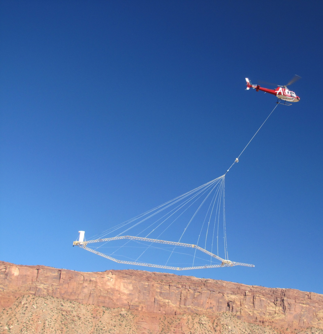
A low-flying helicopter towing a large cylindrical sensor, called a “bird,” collected airborne electromagnetic resistivity data in Nebraska. The helicopter flew about 200 feet above the ground at a speed of about 70 miles per hour. Photo by Jesse T. Korus, 2008. Public domain.
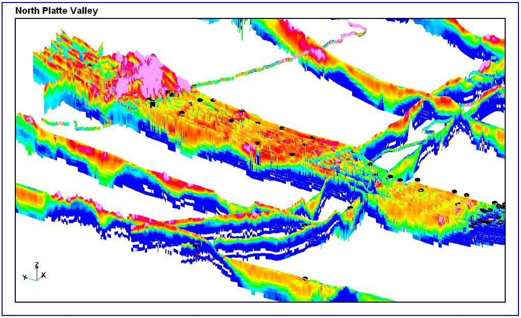
Example of resistivity data collected from an airborne electromagnetic survey. Areas with high resistivity as warm colors (reds) and low resistivity as cool colors (blues).
- Ball, L.B., Smith, B.D., Minsley, B.J., Abraham, J.D., Voss, C.I., Astley, B.N., Deszcz-Pan, Maria, and Cannia, J.C., 2011, Airborne electromagnetic and magnetic geophysical survey data of the Yukon Flats and Fort Wainwright areas, central Alaska, June 2010: U.S. Geological Survey Open-File Report 2011–1304, 21 p. [Also available at http://pubs.usgs.gov/of/2011/1304/ ]
- Smith, B.D., Abraham, J.D. ., Cannia, J.C., Steele, G.V., and Hill, P.L., 2008, Helicopter electromagnetic and magnetic geophysical survey data, Oakland, Ashland, and Firth Study areas, Eastern Nebraska, March 2007: U.S. Geological Survey Open-File Report 2008-1018, 16 p. [Also available at https://pubs.usgs.gov/of/2008/1018/ ]
- Smith, B.D., Grauch, V.J.S., McCafferty, A.E., Smith, D.V., Rodriguez, B.R., Pool, D.R., Deszcz-Pan, Maria, and Labson, V.F., 2007, Airborne electromagnetic and magnetic surveys for ground-water resources—A decade of study by the U.S. Geological Survey, in Milkereit, B., ed., Proceedings of Exploration 07—Fifth decennial international conference on mineral exploration: Conference held September 9–12, 2007, Toronto, Canada, p. 895–899.