Ozark Plateaus Groundwater Availability Study Products
Professional Paper 1854
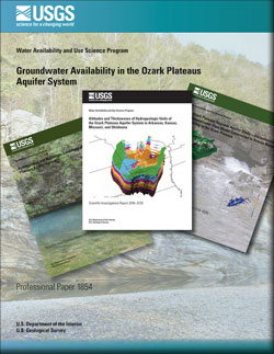
Groundwater Availability in the Ozark Plateaus Aquifer System
by B.R. Clark, L.L. Duncan, and K.J. Knierim, 2019
Groundwater Availability in the Ozark Plateaus Aquifer System
by B.R. Clark, L.L. Duncan, and K.J. Knierim, 2019
Data Release
MODFLOW-NWT model of groundwater flow in the Ozark Plateaus aquifer system (version 1.1)
by L.L. Duncan and B.R. Clark, 2019
MODFLOW-NWT model of groundwater flow in the Ozark Plateaus aquifer system (version 1.1)
by L.L. Duncan and B.R. Clark, 2019

Scientific Investigations Report 2018-5035
Documentation of a groundwater-flow model constructed to assess water availability in the Ozark Plateaus (version 1.0)
by B.R. Clark, J.M. Richards, and K.J. Knierim, 2018
Documentation of a groundwater-flow model constructed to assess water availability in the Ozark Plateaus (version 1.0)
by B.R. Clark, J.M. Richards, and K.J. Knierim, 2018
Data Release
MODFLOW-NWT model of groundwater flow in the Ozark Plateaus aquifer system (version 1.0)
by L.L. Duncan and B.R. Clark, 2018
MODFLOW-NWT model of groundwater flow in the Ozark Plateaus aquifer system (version 1.0)
by L.L. Duncan and B.R. Clark, 2018

Animation
Groundwater use from the Ozark Plateaus aquifer system, 1900 to 2010
Groundwater use from the Ozark Plateaus aquifer system, 1900 to 2010

Journal article
Challenges for creating a site-specific groundwater-use record for the Ozark Plateaus aquifer system (central USA)
by K.J. Knierim, A.M. Nottmeier, S. Worland, D.A. Westerman, and B.R. Clark, 2017
Challenges for creating a site-specific groundwater-use record for the Ozark Plateaus aquifer system (central USA)
by K.J. Knierim, A.M. Nottmeier, S. Worland, D.A. Westerman, and B.R. Clark, 2017
Scientific Investigations Report 2016-5137
Hydrogeology and hydrologic conditions of the Ozark Plateaus aquifer system
by P.D. Hays, K.J. Knierim, B.K. Breaker, D.A. Westerman, and B.R. Clark, 2016
Hydrogeology and hydrologic conditions of the Ozark Plateaus aquifer system
by P.D. Hays, K.J. Knierim, B.K. Breaker, D.A. Westerman, and B.R. Clark, 2016
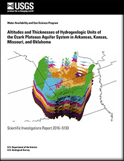
Scientific Investigations Report 2016-5130
Altitudes and thicknesses of hydrogeologic units of the Ozark Plateaus aquifer system
by D.A. Westerman, J.A. Gillip, J.M. Richards, P.D. Hays, and B.R. Clark, 2016
Altitudes and thicknesses of hydrogeologic units of the Ozark Plateaus aquifer system
by D.A. Westerman, J.A. Gillip, J.M. Richards, P.D. Hays, and B.R. Clark, 2016

Data Release
Altitudes and thicknesses of hydrogeologic units of the Ozark Plateaus aquifer system
by D.A. Westerman, J.A. Gillip, J.M. Richards, P.D. Hays, and B.R. Clark, 2016
Altitudes and thicknesses of hydrogeologic units of the Ozark Plateaus aquifer system
by D.A. Westerman, J.A. Gillip, J.M. Richards, P.D. Hays, and B.R. Clark, 2016
Data Release
Groundwater withdrawal rates from the Ozark Plateaus aquifer system, 1900 to 2010
by K.J. Knierim, A.M. Nottmeier, S. Worland, D.A. Westerman, and B.R. Clark, 2016
Groundwater withdrawal rates from the Ozark Plateaus aquifer system, 1900 to 2010
by K.J. Knierim, A.M. Nottmeier, S. Worland, D.A. Westerman, and B.R. Clark, 2016
Data Release
Sinkholes and Springs of the Ozark Physiographic Province, northern Arkansas, from Topographic Maps
by N.L Turner, K.J. Knierim and T. Kresse, 2016
Sinkholes and Springs of the Ozark Physiographic Province, northern Arkansas, from Topographic Maps
by N.L Turner, K.J. Knierim and T. Kresse, 2016
Data Release
Regional potentiometric surface dataset of the Ozark aquifer in Arkansas, Kansas, Missouri, and Oklahoma, November 2014 - January 2015
by A.M. Nottmeier, 2016
Regional potentiometric surface dataset of the Ozark aquifer in Arkansas, Kansas, Missouri, and Oklahoma, November 2014 - January 2015
by A.M. Nottmeier, 2016
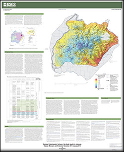
Scientific Investigations Map 3348
Regional potentiometric surface of the Ozark aquifer in Arkansas, Kansas, Missouri, and Oklahoma, November 2014-January 2015
by Anna M. Nottmeier, 2016
Regional potentiometric surface of the Ozark aquifer in Arkansas, Kansas, Missouri, and Oklahoma, November 2014-January 2015
by Anna M. Nottmeier, 2016
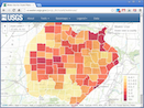
Interactive map
Water use in the Ozarks
Water use in the Ozarks
Data Release
Ozark Plateaus seepage run dataset, southern Missouri and northern Arkansas, 1982-2006
by K.J. Knierim, D.M. Wagner, V.L. Roland and A.M. Nottmeier, 2015
Ozark Plateaus seepage run dataset, southern Missouri and northern Arkansas, 1982-2006
by K.J. Knierim, D.M. Wagner, V.L. Roland and A.M. Nottmeier, 2015

Video
Groundwater, a source to streams in the Ozark Plateaus
Groundwater, a source to streams in the Ozark Plateaus