It is common for people to need scientific information within a named geographic area. But geographic names are numerous, diverse, and are not unique. A well designed controlled vocabulary of named geographic areas can be used to enable users to identify geographic areas in their proper context and without ambiguity. This vocabulary has been created using freely available geospatial resources and existing unique identifiers other than the names themselves, such as FIPS codes and hydrologic unit codes. It has been implemented extensively on MRData and some other USGS web sites.
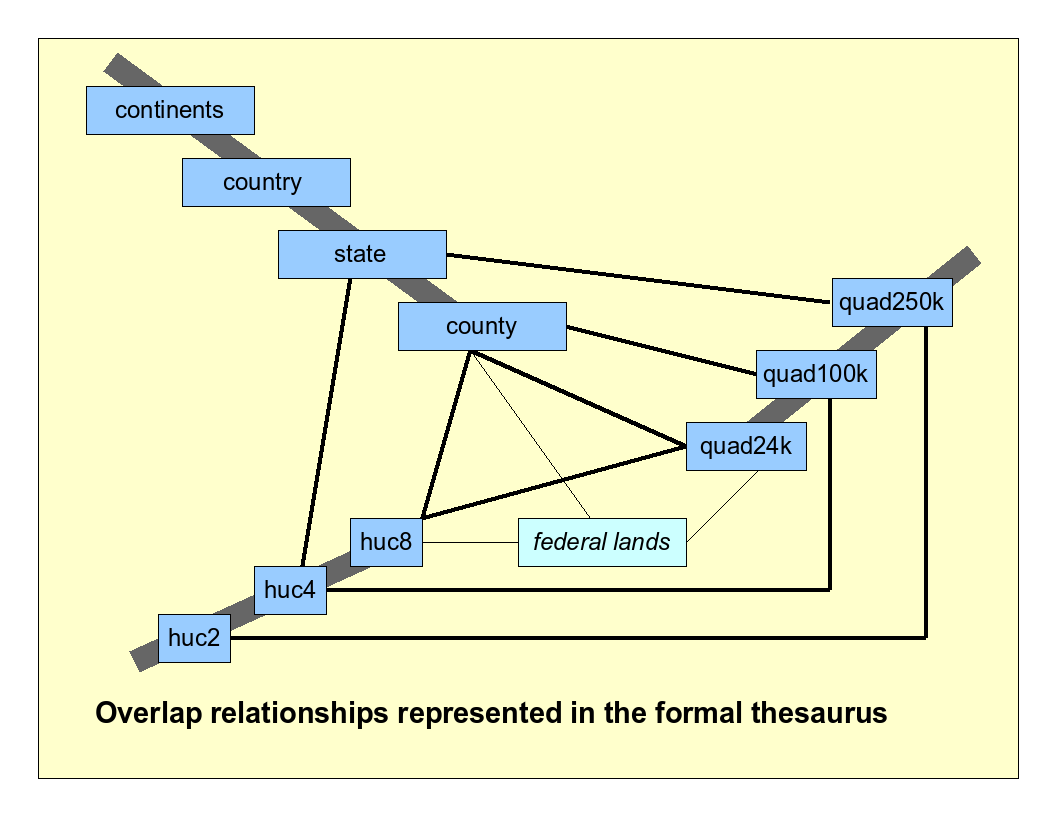
Diagram showing types of geographic areas included in the controlled vocabulary. Heavy gray lines indicate hierarchical relationships. Thinner black lines indicate geospatial overlaps that are stored in the vocabulary as "see also" links.
An alternate version of this form allows entry of coordinates in degrees, minutes, and seconds.