Ozark Plateaus Groundwater Availability Study Conceptual Model
How does groundwater enter and move through the Ozarks?
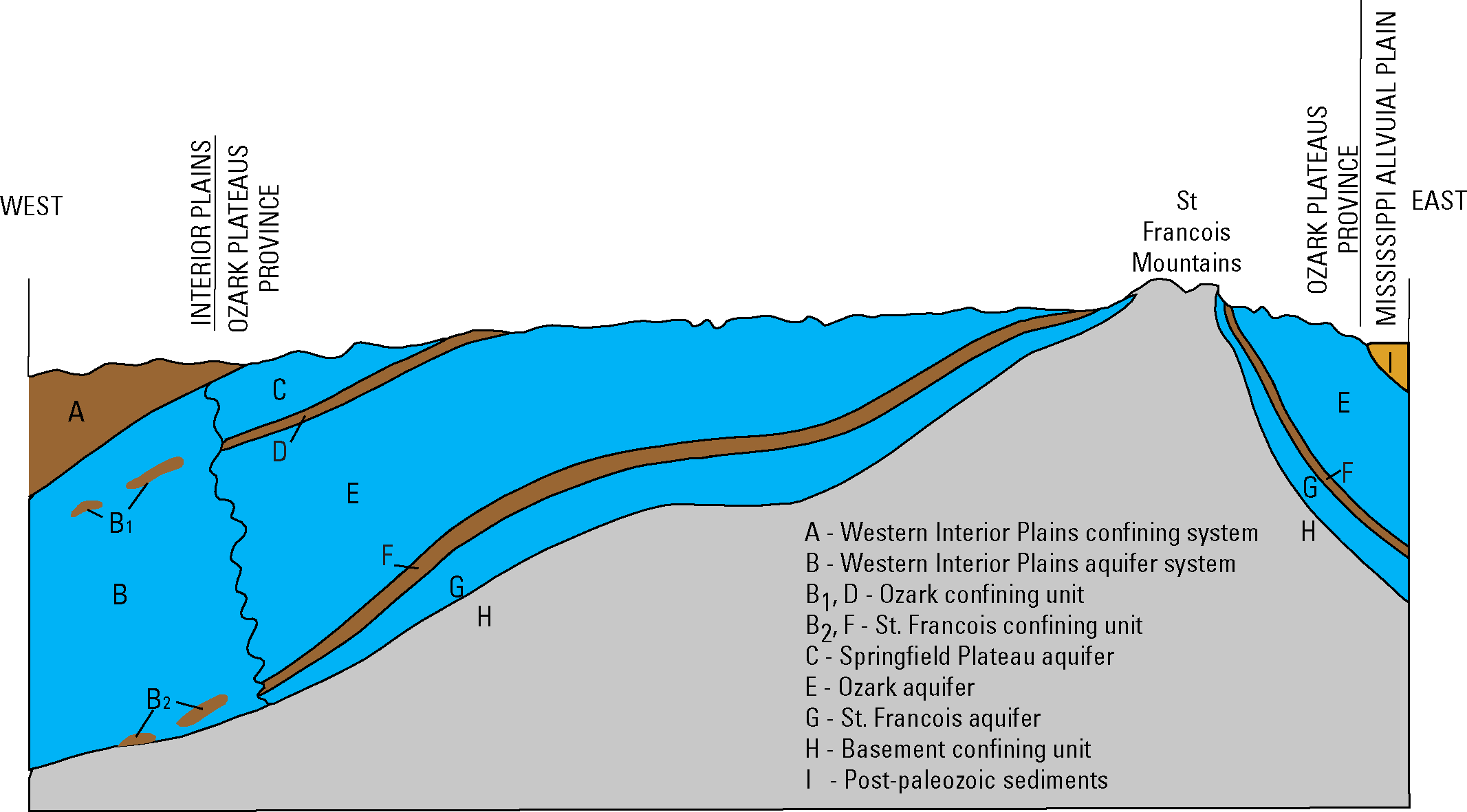
Because the Ozarks are made up largely of consolidated rocks of dolomite, sandstone, limestone, shale, and chert - the primary flow path for groundwater is through fractures and karst features. Recharge into the system occurs primarily from infiltration of precipitation (both diffuse and through sinkholes) and river leakage (Czarnecki and others, 2009).
Groundwater then moves through the subsurface in a shallow and deep system. The shallow system reflects a quick-flow component of water entering sinkholes and moving through caves and solution enlarged fractures. The deep system is recharged by diffuse and fracture flow from overlying units and moves more slowly through the system (Richards, 2010). Discharge occurs as seepage to rivers, lakes, and springs, lateral flow into adjacent units, and through pumping wells.