
Mississippi Embayment Aquifer System Regional Groundwater Availability Study
What is the Effect?
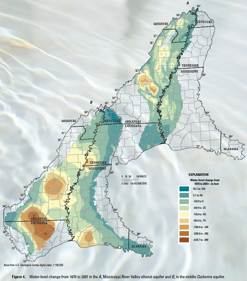 Water-level declines have occurred across large areas in the Mississippi embayment because of groundwater pumping. Water-level declines in the alluvial aquifer are noticeable throughout Arkansas and parts of Mississippi. Model simulations indicate 216 square miles (about 0.7 percent of the study area) of declines of more than 100 feet in the alluvial aquifer by 2007 (fig. 4). Waterlevel declines in the middle Claiborne aquifer are more dramatic with 7,529 square miles (13.3 percent ) showing water-level declines of more than 100 feet by 2007. The largest declines of more than 300 feet in water-level declines in the middle Claiborne aquifer occur in southern Arkansas and northern Louisiana. Water-level declines are much greater in the middle Claiborne aquifer because it is under confined conditions, unlike the alluvial aquifer. Small changes in pumping from the middle Claiborne aquifer result in large changes in water level.